Comprehensive Mapping
Mapping is available as a feature in Retrieval and works like the Retrieval Widget map display. Note that a Mapping license is required to enable the use of this feature.
To begin using mapping, two separate columns will need to be configured for the Latitude and Longitude coordinates of interactions on the server. This can be done by an administrator. Note that depending on how an administrator configures these columns, they may not be captioned with “Latitude” and “Longitude”. After the columns have been configured, check with an administrator on which columns are to be used with mapping.
When the Latitude and Longitude columns have been configured, they will need to be added to the report. When both columns are present in the report, the “Display Map” button will appear as an action item under the menu bar, to the right of the Refresh Grid button.
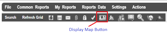
Note that both Latitude and Longitude must be present in the report. If either column is missing, the button will not be visible.
The Display Map button will provide the following options when clicked on:
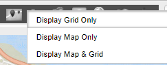
Display Grid Only – Hides the map so that only the grid is visible.
Display Map Only – Hides the grid so that only the map is visible.
Display Map & Grid – Displays both the map and grid together.
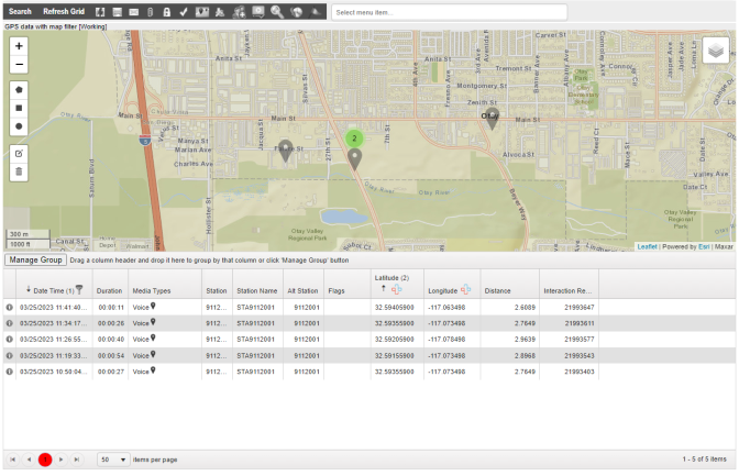
Mapping in Retrieval